no.2
地図で見る
1.17 被災地の全体像
Learning from maps
Overall image of disaster-affected area
兵庫県南部地域の大型マップや、市区町単位の人的被害・建物被害データで、被災地の状況を把握しよう。
We can grasp the damage to victims and buildings in each municipality through the data shown on this large map of the southern Hyogo area.
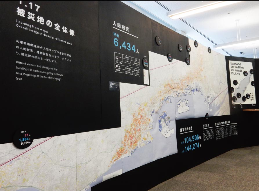
平成7 年4月国土地理院 発行
『平成7 年兵庫県南部地震災害現況図(第Ⅱ版)』を繋ぎ合わせた大地図
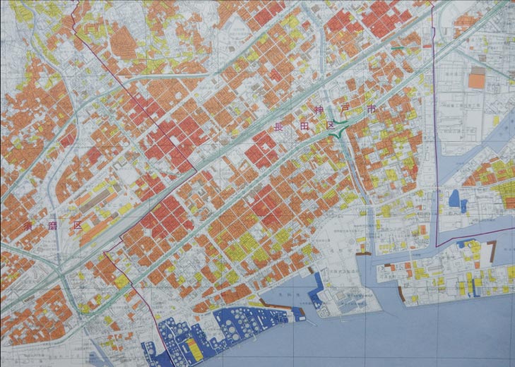
部分図 神戸市長田区付近
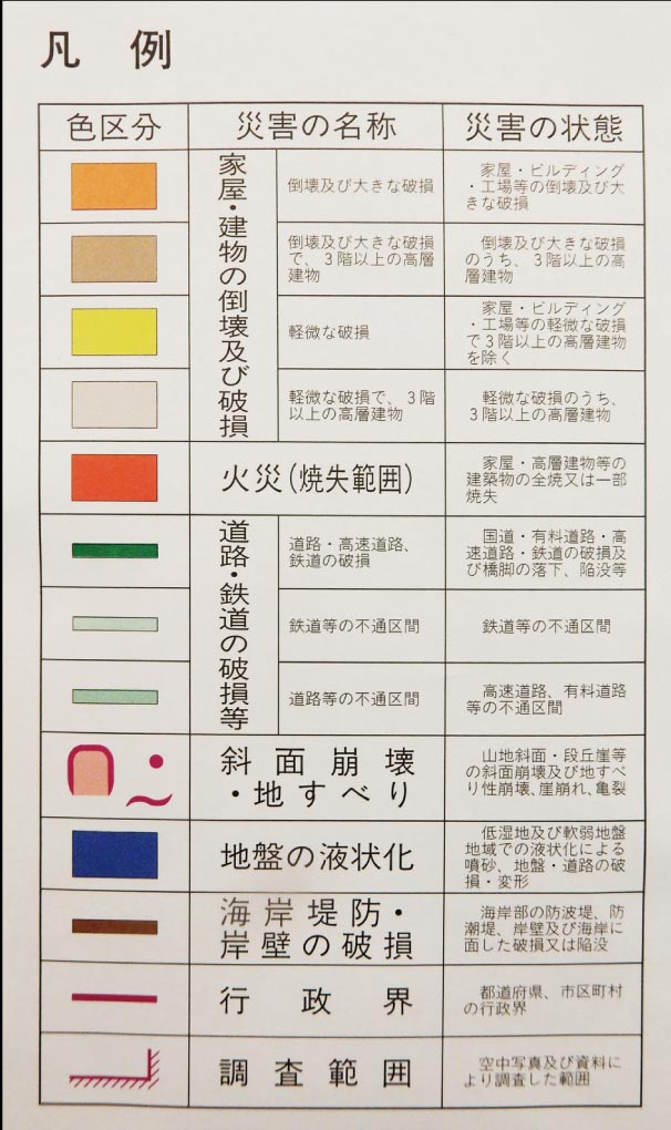
凡例
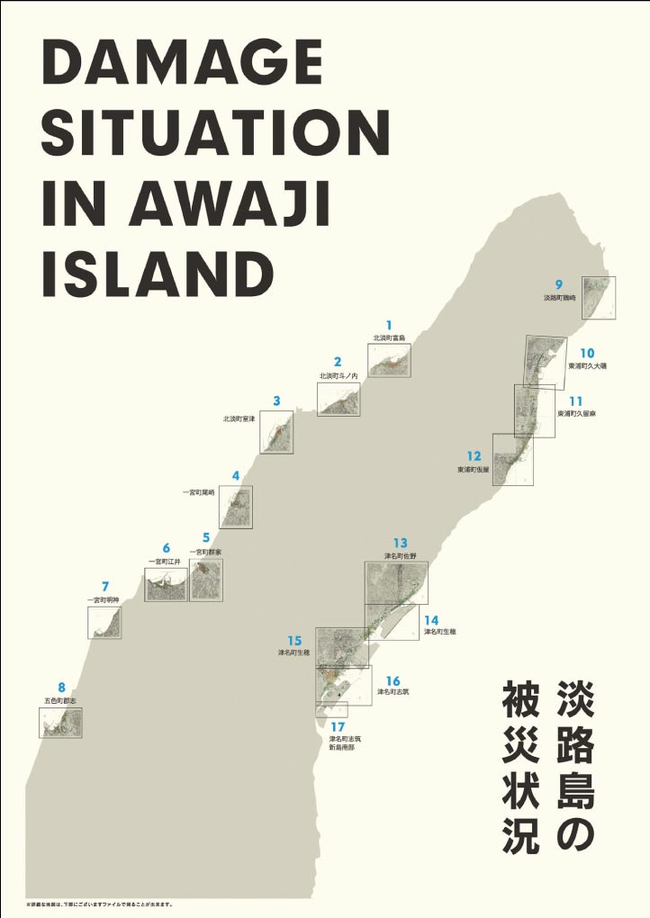
淡路島の被災状況
震災復興都市づくり委員会による調査データ『被災度別建物分布図』を基に作成